Related posts
Feature
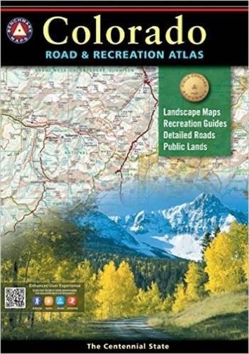
Atlases: Every Benchmark atlas is specially designed for enthusiasts of hunting, fishing, camping, boating, hiking, and other outdoor activities. All atlases have Benchmarks exclusive Landscape Maps with large easy-to-read and page overlap, and a useful GPS grid. The categorized Recreation Guide makes planning your next adventure a breeze. The Recreation Maps have public land ownership shown as color tints, and most titles have hunting unit names and boundariesRecreational Maps: Benchmarks Recreation Maps were created for outdoor lovers who want the high quality recreation information in our atlases but with the convenience of a traditional folding map. Complete public lands detail and hunting unit boundaries are shown as well as categorized recreation listings.
Description
Colorado's mountains are the source of everything that makes Colorado unique. No other publication can display this entrancing scenery and its recreation potential with more precision than Benchmark's Colorado Road and Recreation Atlas. The Recreation Guide has complete categorized listings and the recreation maps show complete public land ownership.- Map Scale = 1:200,000 & 1:500,000
- Sheet Size = 11" x 16"